Walk • Trek • Travel
A photographic record and journal of our walking, trekking and travelling adventures.

Portland Loop
Sunday 25 March 2018
I slept well at the Portland YHA and woke early. There were only two
us in an eight-bed dorm so there had been plenty of room and very little
noise.
I headed to the kitchen for some coffee and breakfast and afterwards
to the drying room. I had attempted to clean off the mud from my
waterproofs from the previous day.
My plan today was to walk the coast path around Portland and then
walk into Weymouth to catch a train to Wool. Susan and her friends were
walking in the Lulworth area and would have to pass the small village of
Wool. Luckily there is a train there from Weymouth and the tickets were
very reasonable at £7.
I gathered up my things and headed out leaving the YHA behind. The
Youth Hostel, or Hardy House as it once was, was constructed as a house
for the Royal Navy store officer. Later, it became the HQ for the Royal
Navy Provost, known nowadays as the Royal Navy Police, but with the
closure of RNAS Portland, the house was taken over by the YHA.
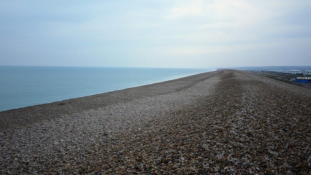
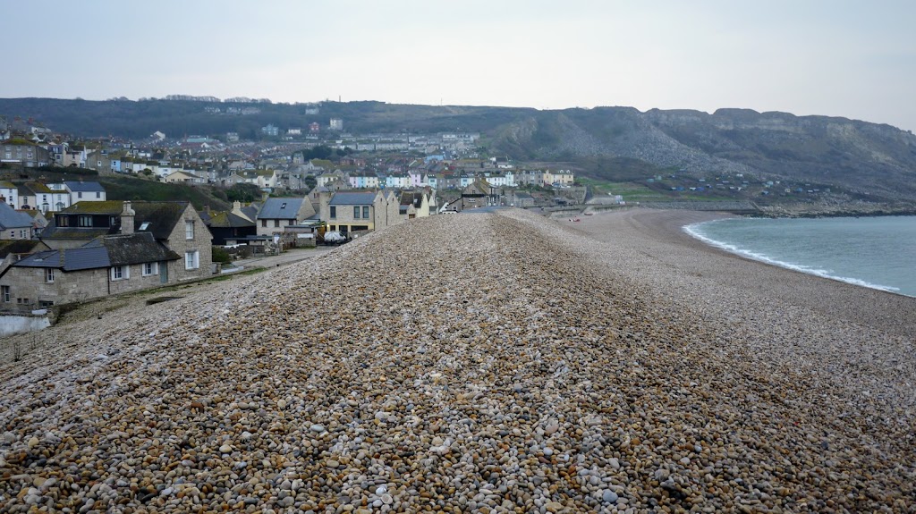
I walked back down the hill to the point I had left the path the day
before and climbed up the enormous bank that is Chesil Beach.
Chesil Beach
Chesil Beach is eighteen miles long, two hundred metres wide and
fifteen metres high and together with the Fleet, form part of the
Jurassic Coast and a UNESCO World Heritage Site.
I walked along the huge pebble bank until the pebbles subsided and
eventually became the seawall. At the end of the wall, I headed up the
steep hill, sticking to the Portland Coast Path, as it skirted the edge
of West Cliff.
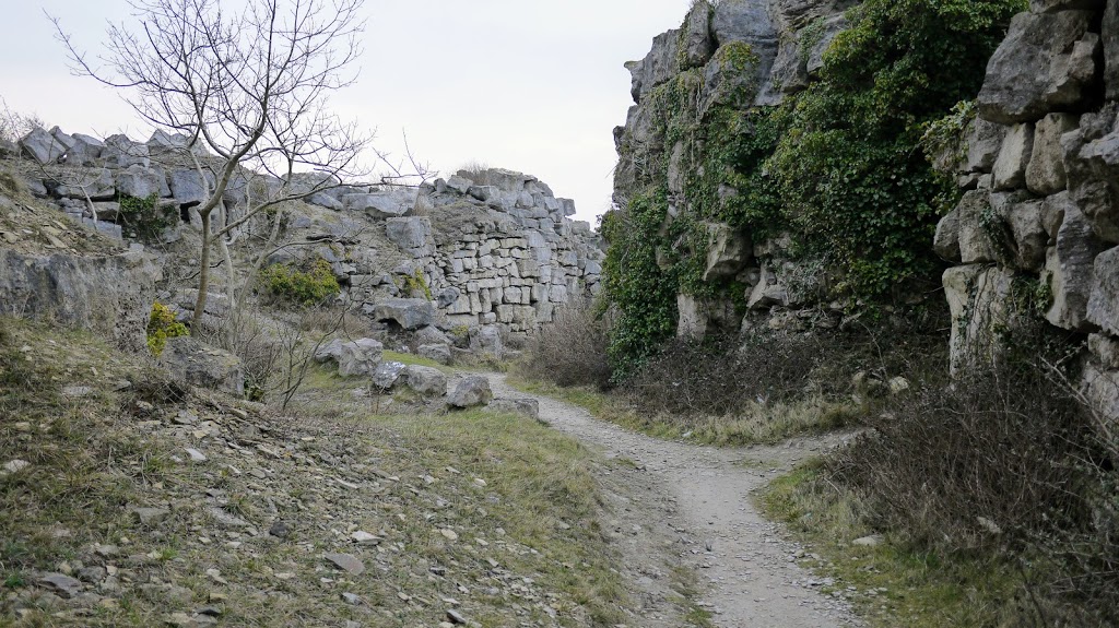
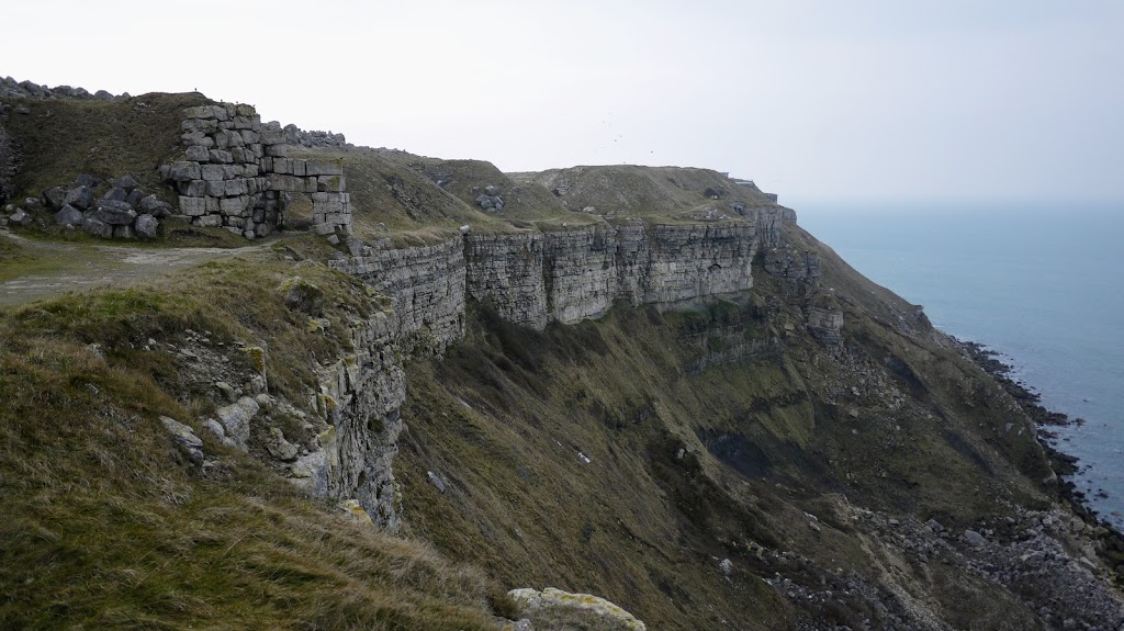
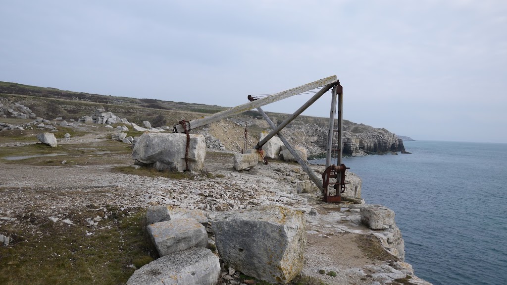
Tout Quarry Sculpture Park
This was a truly fascinating place. Tout Quarry was one of eighty
working quarries on the Island and dates back to around 1750 when it was
originally worked by hand. It was last worked in 1982 when 30,000 tons
were excavated and in 1983 the Sculpture Park opened there.I didn’t get
far before I a came across the entrance of the Tout Quarry Sculpture
Park and decided to investigate.
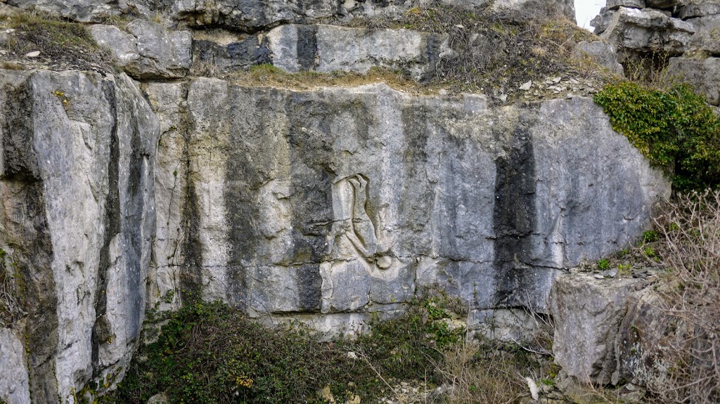
Today, the Sculpture Park contains more than sixty hidden sculptures
from national and internationally renowned artists including Antony
Gormley.
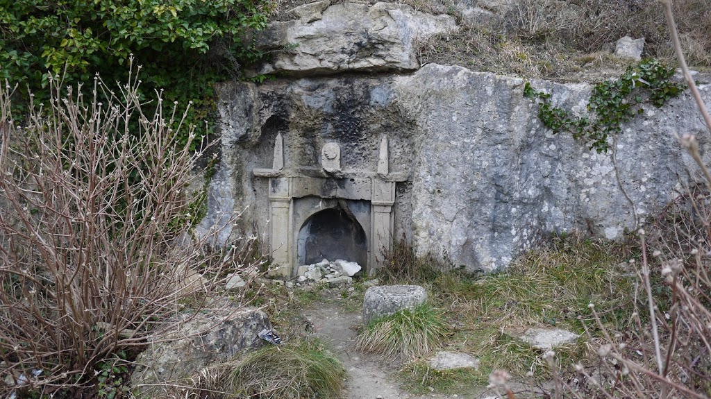
You could easily spend an hour walking around this park, if not more.
I head back to the entrance and then the coast path and continued my
journey. I had not gone far when I found the path head closed due to
landslides and was forced back into the Sculpture Park for a detour but
I was soon back on the coast path.
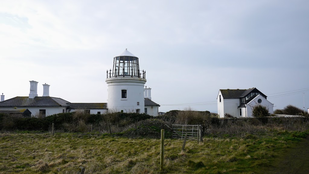
Trinity House Lighthouses
I continued along the flat top of the cliffs and eventually came
across Old Higher Lighthouse. I didn’t know that there were several
lighthouses on Portland. I was only aware of the main one on Portland
Bill but Old Higher Lighthouse is one of a pair that came in to use in
1716 and were rebuilt in 1869. The lighthouse at Portland Bill was built
in 1905 to replace the two older lighthouses.
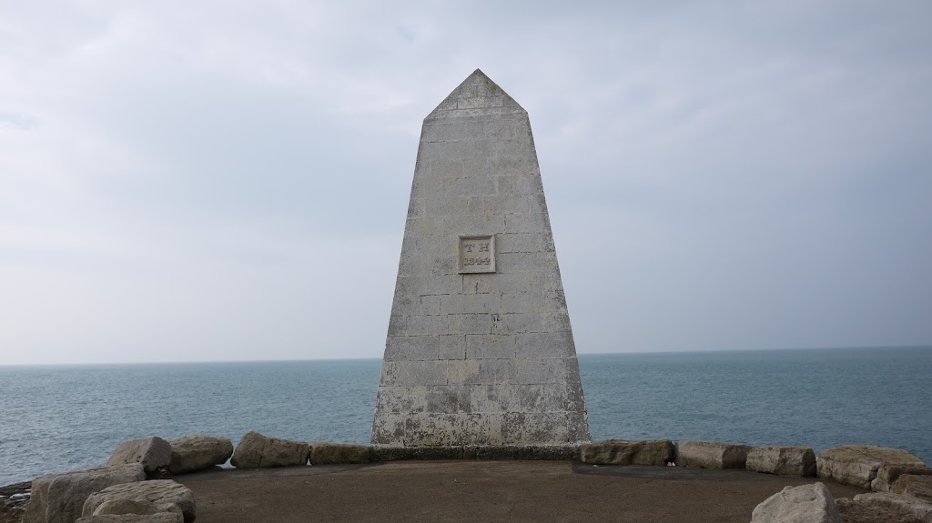
The Trinity House Obelisk is a daymark built in 1844 to warn ships
off the coast of Portland Bill. The obelisk is made of Portland stone
and is seven metres in height.I passed the Coast Guard lookout, now used
by the National Coastwatch volunteers and then had to navigate around
some sort of small MOD base which I later discovered was the Ministry of
Defence Magnetic Range before reaching the southern tip of Portland Bill
and the Trinity House Obelisk.
In the photo below, you can also see the second of the older
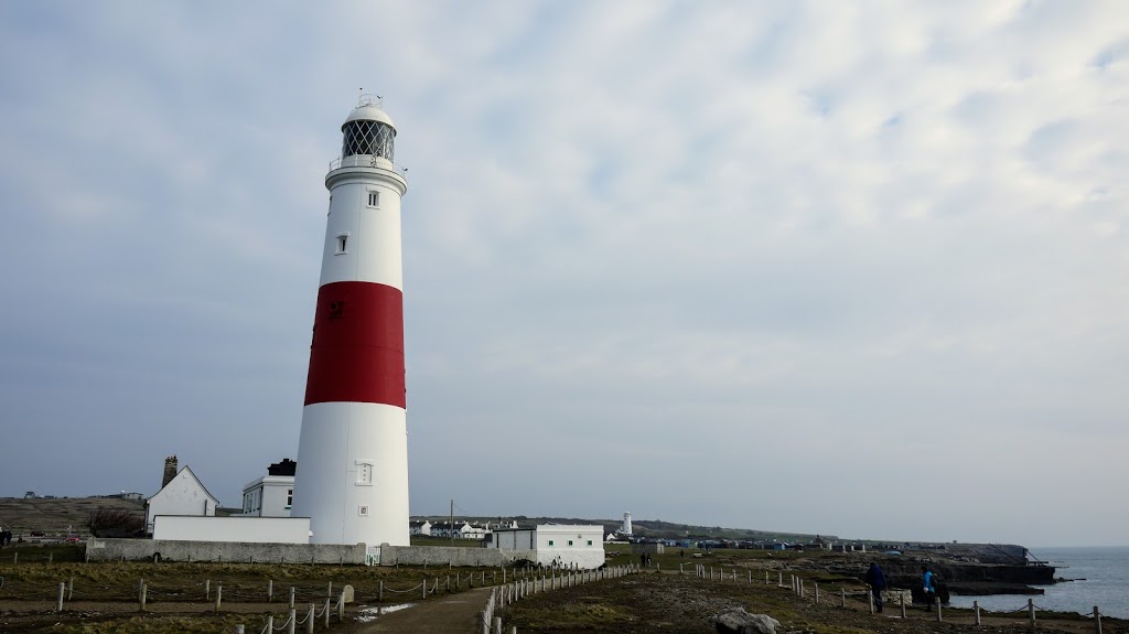
lighthouses, Old Lower Lighthouse, in the distance.Portland Bill,
however, is dominated by the newer Lighthouse, if 1905 can be considered
to be new. Standing at forty-three metres and painted white with a broad
red stripe, it is impossible to miss.
Having spent the morning walking South, I was now about to head North
giving me the false impression of being halfway. I was not.
Heading North
I had walked about five miles and the total distance for today was
more like seventeen miles but at least today had been more interesting
than yesterdays walk.
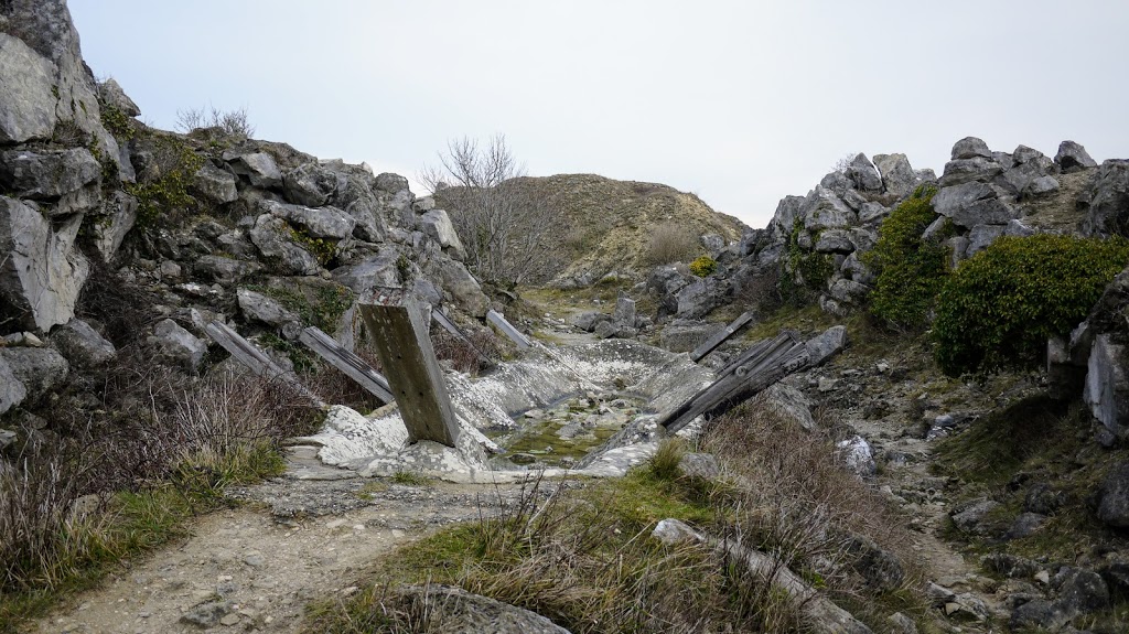
I explored the nooks and crannies of the quarries along the coastline
with only a temporary diversion to the road at Freshwater Bay returning
to yet another quarry just passed the Cheyne Wears carpark.
The OS Map shows this as “Southwell Landslip” but there seemed to me
to be plenty of evidence of quarrying activity of some sort. The coast
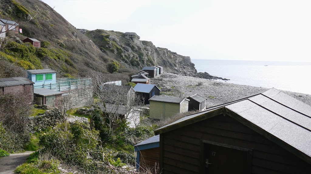
path brought me out to Church Ope Cove and a small group of beach huts
above which, on the cliff edge, where the remains of Rufus Castle.
It is believed that the first recorded Viking attack on the British
Isles happened on Portland at Church Ope Cove which may explain why a
Castle was later built overlooking the cove.The remains date back to the
fifteenth century but the original castle was built in the twelfth
century making it the oldest castle on Portland. It was named after King
William II (William Rufus).
Nearby are also the remains of St. Andrew’s Church. St Andrew’s was
Portland’s first parish church and remained as such until the
mid-eighteenth century. It was built in 1100 AD on what was thought to
be the site of a Saxon church. Although right next to Rufus Castle,
French raiders managed to land at Church Ope Cove and burn down St
Andrews not once, but twice (1340 and 1404) on both occasions, the
church was rebuilt.
I followed the path up behind the beach huts and then down again on
the other side. The South West Coast path continues along the top of the
Grove Cliff but I missed this and walk along the bottom of the Penn’s
Weare and Grove Cliff.
Eventually, this path runs out and as I reached the large buttressed
wall of the disused firing range I was forced to take a zigzag path up
the side of the cliff to join the main Coastal Path.
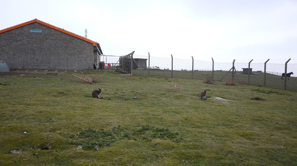
Her Majesty’s Pleasure
As I reached the top of the path I found my self outside of HM Young
Offender Institution. I walk along the high, protected fences half
expecting to see some of the inmates exercising in the yards on the
other side or something but in fact, I did not see a soul.
I pondered the reasons why Her Majesty might be keeping wallabies at
her pleasure for a short while until a sign, further down the road,
ended the process abruptly. It read “Fancys Farm”.
I continued around the end of the facility and across a large open
grass section on to a road. There were more fences here but not so
protected or harsh looking. I then noticed some movement out of the
corner of my eye and was somewhat surprised to see some wallabies
shuffling around.
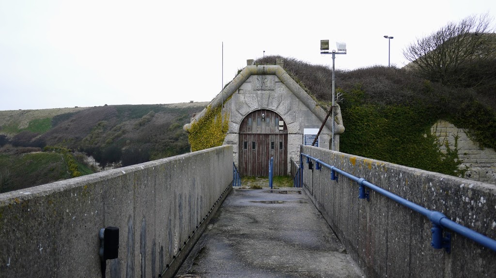
Verne Citadel
At the end of the road there was a sharp turn left, immediately my
eye was drawn to a bridge over a dry moat and seemingly into a hill. I
knew at once that this was the Verne Citadel and that the gate on the
other side of the bridge was one of only two entrances. The other being
a tunnel on the north side of the citadel.
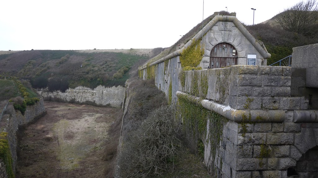
Built as Portland Harbour’s main defensive fortification between1857
and 1891 its defensive role lasted only until 1903 when it was used a
barracks and by 1949 it had been converted into a Category C prison, HMP
Verne.
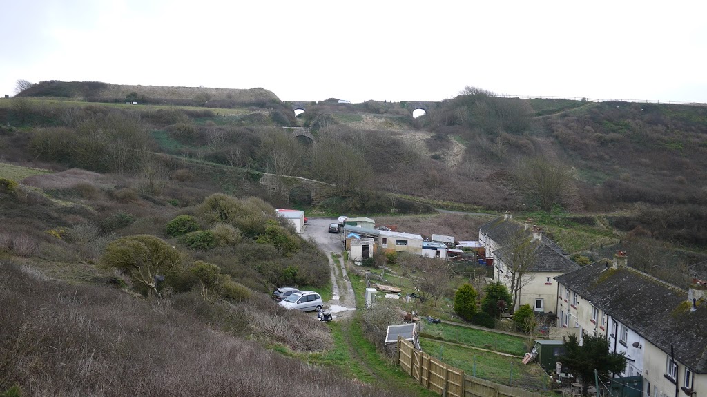
The path descended around the edge of the moat before joining the
Merchants Incline, a horse-drawn and cable operated incline railway
built for the stone trade on the island. It was in operation from 1826
to 1939. The disused railway is now a path and I followed it all the way
down to the harbour at Castletown.
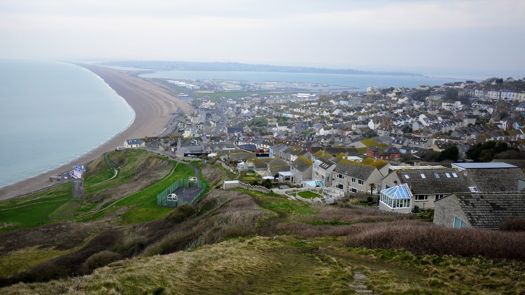
Weymouth
I continued through the marina and back towards Ferrybridge. Just
over the bridge, the South West Coast Path joins the Rodwell Trail for
as far as Castle Cove. I decided to stay on the Rodwell Trail because it
was a disused railway line, part of Weymouth and Portland Railway, and
almost all the way to the train station, which was where I needed to go.
On a Sunday afternoon, this was a busy trail!
I reached the station and purchased my ticket for Wool but the next
train was going to be almost an hour so I would have to amuse my self
for a bit.
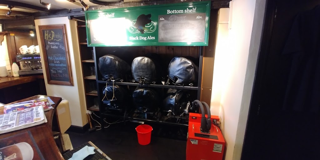
I found refuge in the Black Dog Inn, reputed to be the oldest pub in
Weymouth dating back to the 1500s. This was a proper pub with proper
beer!
The Route
Distance : 17 Miles
I started my walk from the Youth Hostel on Portland and ended in
Weymouth.
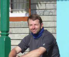
Are you tired of being stuck in the office? Bored of being chained to a desk? Counting down the days until retirement?
Me too!!
CATEGORIES
FOLLOW US


RECENT POSTS
-
 Tuesday 01 February 2022
 -
 Monday 31 January 2022
 -
 Sunday 30 January 2022
 -
 Saturday 29 January 2022
 -
 Friday 28 January 2022
 -
 Thursday 27 January 2022
 -
 Wednesday 26 January 2022
 -
 Tuesday 25 January 2022
 -
 Monday 24 January 2022
 -
 Sunday 23 January 2022
 -
 Saturday 22 January 2022
 -
 Friday 21 January 2022
 -
 Thursday 20 January 2022
 -
 Sunday 02 January 2022
 -
 Saturday 01 January 2022
 -
 Wednesday 27 October 2021
 -
 Tuesday 26 October 2021
 -
 Sunday 02 May 2021
 -
 Sunday 04 October 2020
 -
 Saturday 03 October 2020