Walk • Trek • Travel
A photographic record and journal of our walking, trekking and travelling adventures.

Laugavegur Trail Iceland
Sunday 31 August 2014
Sitting on the plane at Luton all ready to head off for our Icelandic
adventure was not the time we wanted to hear the Captain announcing that
there would be a delay as Iceland had just closed off their air space to
all flights. This was not the best of starts! Bárðarbunga an Icelandic
volcano in the lava field of Holuhraun was threatening to erupt. This
news had been rumbling around for a couple of weeks before we left but
we really did not think it would affect us! An hour and a half of
slightly tense waiting on the plane followed before the pilot announced
that airspace was open and we could fly. At least we would get there and
would worry about getting back when that time came. The volcano did go
on to erupt a couple of days before we left but the effects were
localised and did not affect international flights – luckily!
Reykjavik
Finally arriving at lunchtime on day one gave us just half a day to
have a look around Iceland’s capital city Reykjavik. It is a small city,
the most northerly capital city in the world at 64 degrees north, and it
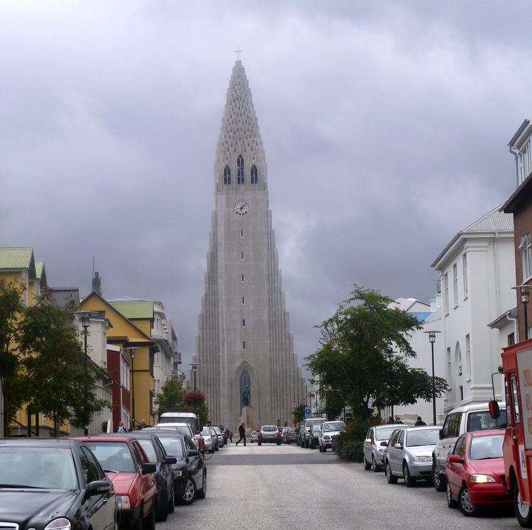
is possible to see a good bit of it in a short time. The main attraction
is the Hallgrimskirkja church which at 74.5m high is the tallest
building in Reykjavik and is visible from most of the rest of the city.
It was designed by Guðjón Samúelsson in 1937 and represents the forms
and shapes when lava cools into basalt rock. It is certainly an iconic
landmark, Reykjavik’s Eiffel Tower.
Unfortunately, we left it too late to visit to be able to see inside
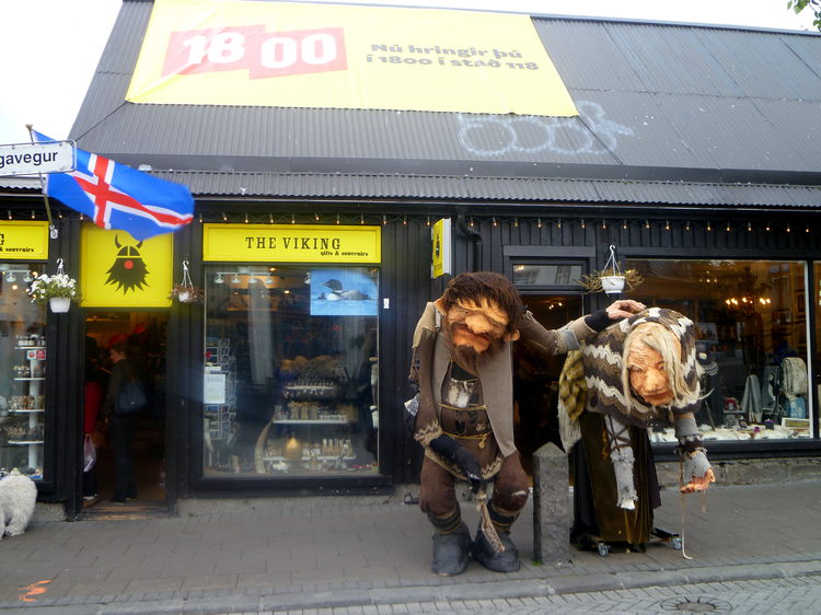
but the outside is still well worth a look. The rest of the city is
small and quaint with lots of tourist shops and some interesting
inhabitants.
It has a lovely safe feel but just make sure you take plenty of Krona
with you as nothing is inexpensive here.
Landmannalaugar
The next day saw us head out of Reykjavik for the 5-hour transfer to
Landmannalaugar and the start of our trek We would be following the 55km
long Laugavegur and the 28km Fimmvörðuháls and Eyjafjallajökull trails
which together would take us south for 5 days ending at the coast at the
60m high Skogarfoss Waterfall.
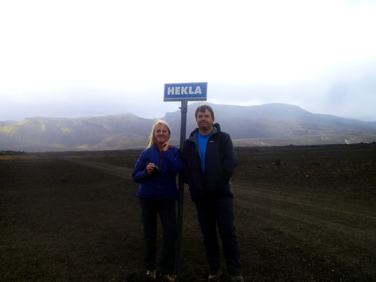
We first headed east across the high moorland of Hellisheidi stopping
en route at a dedicated “photo opportunity” to take some snaps of the
1,491m high Hekla volcano. This is one of Iceland’s most active
volcanoes which has erupted over 20 times, the last of which was as
recent as 2000.
The landscape is barren and beautiful with little sign of habitation
or other vehicles for most of the trip yet it is never boring to look
at. The terrain is bumpy and the oversized tyres of the bus were very
necessary. The route meant crossing some pretty deep rivers but the bus
was more than up to the job.
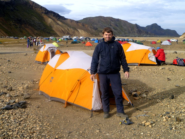
Arrival at the campsite in Landmannalaugar in the Fjallabak Nature
Reserve was the first opportunity to put up our tent, which we would
come to love and set up camp for the first night.
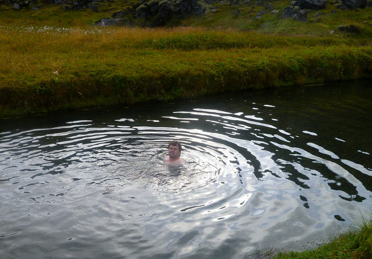
The added bonus at this site are the hot springs that feed into the
pool, our first taste of the geothermal activity which was to mark the
trail for the next couple of days. The water in the pool was hot and the
nearer you got to the source of the water it got very hot!
Hrafntinnusker
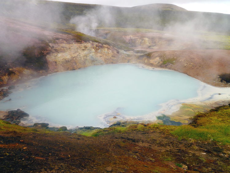
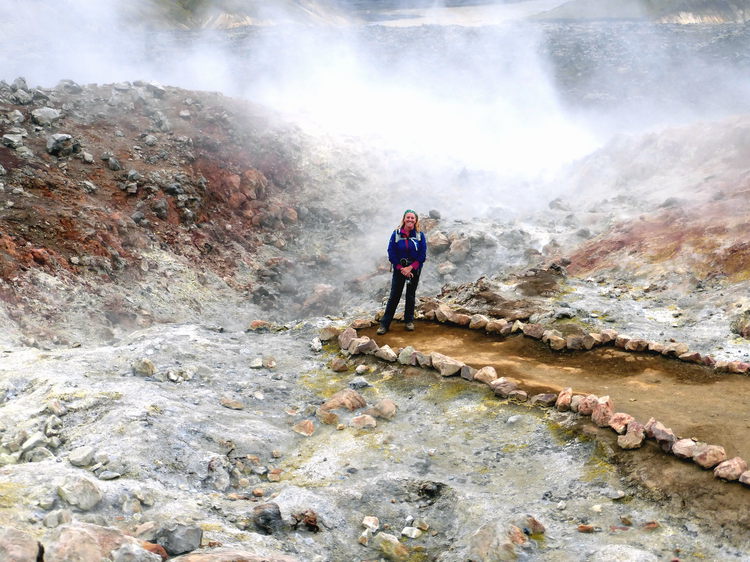
Day three we headed off with our destination being Hrafntinnusker
about 12 km away. The route begins by crossing the 500-year-old
Laugahraun lava flow that still provides heat to the Landmannalaugar hot
springs which we had sampled the previous evening. The landscape of the
Stórihver geothermal area we passed through was truly amazing and
other-worldly, hot springs and sulphur vents bubbling all along the
way.
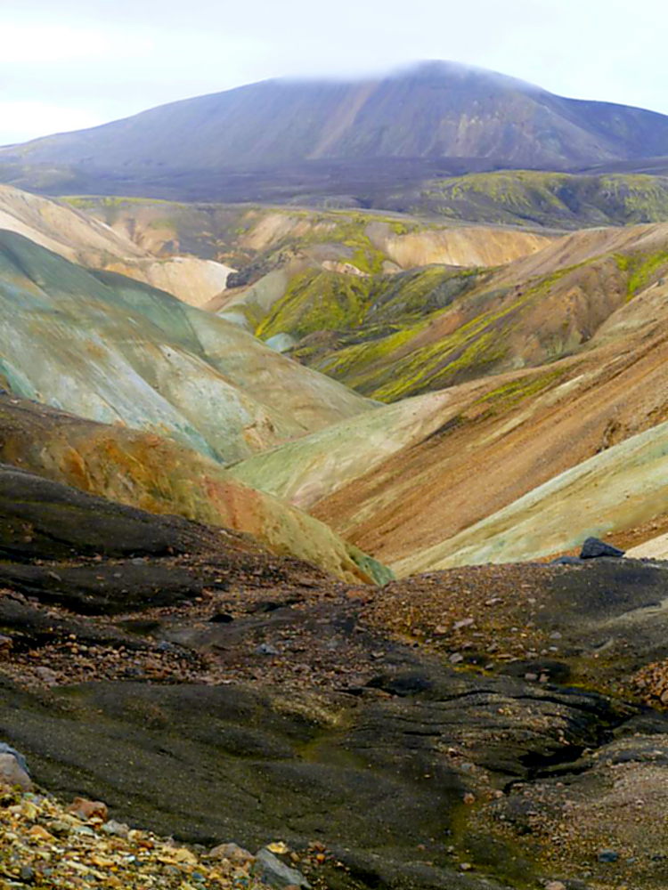
The rocks here are rare rhyolite rocks which give the surprising and
beautiful range of colours to the landscape.
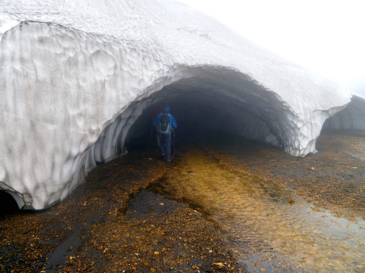
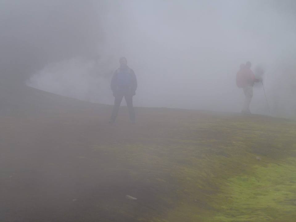
Despite it being August much of the route is still covered by snow
and walking under a snow bridge was a first for me. Fog is also
apparently a common feature of an Icelandic summer that we were lucky
enough to see plenty of!
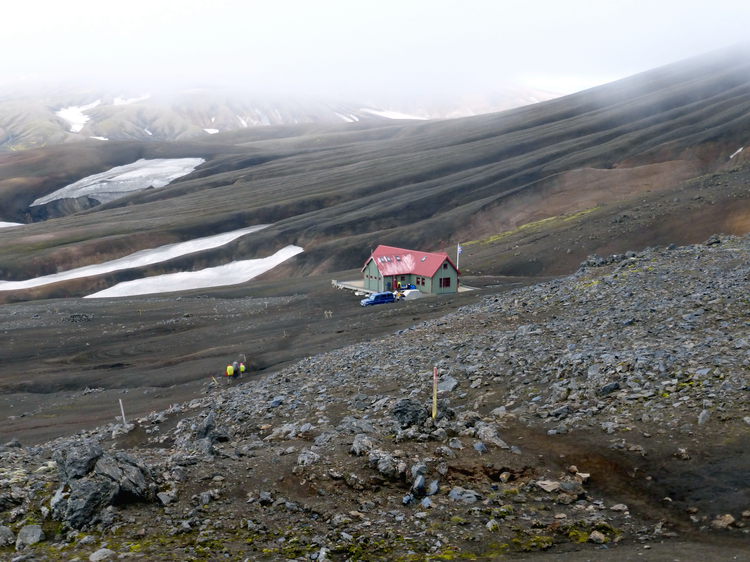
Camp 2 at Hrafntinnusker came into sight after what had seemed like a
much longer walk that the 12km we had covered. Stopping so often to look
at the scenery and take pictures had taken a lot of time but created
some amazing memories. This camp is interesting in as much as the ground
is largely made of obsidian. Very sharp, very hard and not camper
friendly !! The eco-toilets are also not so “nose-friendly”.
Nevertheless, we pitched and spent the night here.
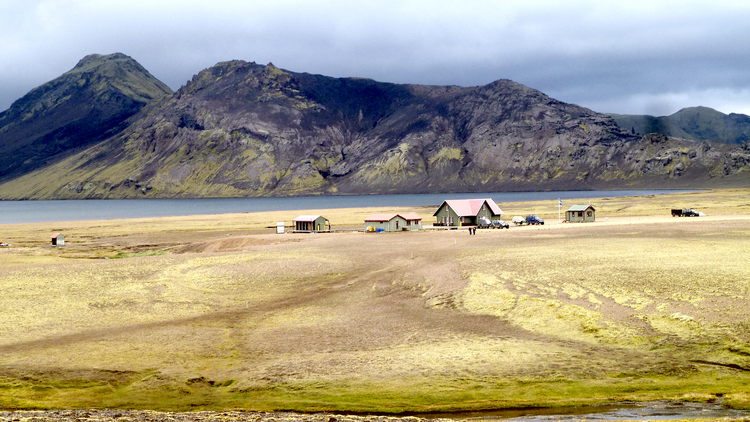
Álftavatn
The next day and our objective is Álftavatn another 12km walk away.
The route takes in more snow bridges, more hot springs and sulphur
pools.
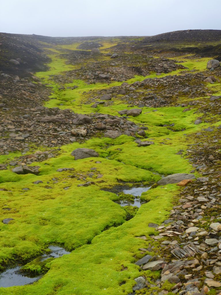
The colourful rhyolite rocks are left behind today but there is more
greenery, often in very vivid colours. This is the Icelandic moss which
is so vital to the local environment and ecosystem and which needs to be
treated with care as feet and car tyres can cause a lot of damage. The
growing season in Iceland is very short and any damage does not have
time to recover before the next winter season.
The landscape changes again during today’s walk as we skirt the
southern edge of the Torfajokull Massif the black sands become the norm
We work our way down the steep slope that ends the day’s walk at the
side of the lake at Álftavatn and once again we pitch the tent of the
night. Tonight’s treat was the prospect of a hot shower, the first of
the trek so far. The shower was great, getting out of the shower in the
cold was not quite so great! A lovely tranquil site right on the shores
of the lake and with a welcome grass area to pitch up on.
Emstrur
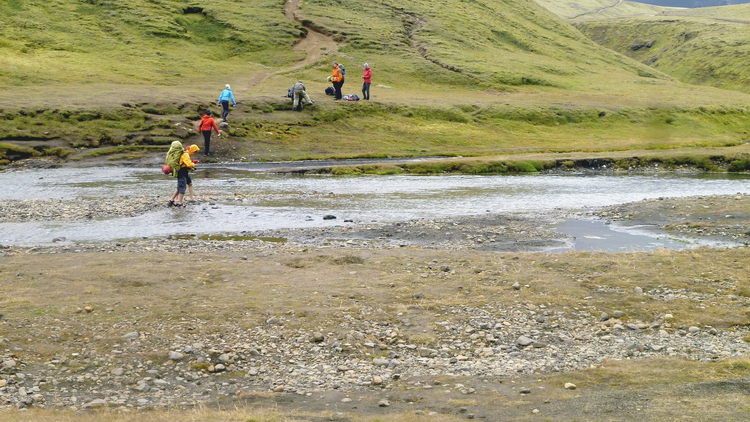
The next day our target was to walk to Emstrur about 19km away with
the added excitement of knowing we had to cross several rivers, not all
of which had bridges. This left the only way over as wading through the
icy glacial melt waters to get to the other side.
The day started calmly with a fairly gentle walk toward the first
river crossing, hills in the distance but a nice flat walk for us.
The first river crossing was easy as the water level was quite low.
No more than rolled up trousers needed for this one, though the water
was very, very cold on the toes.
As we walked on the wind began to whip up and considering it was
August, the temperatures began to drop quite quickly. The second river
was a bit more taxing and with water over my knees which was quite fast
moving it was bracing, to say the least.
As we approached the surreal 5km wide plain of black sand and pumice,
beneath the conical peak of Storasula the wind really picked up speed
and the ash still lying about from the 2010 eruptions of
Eyjafjallajökull was being blown full pelt at us.
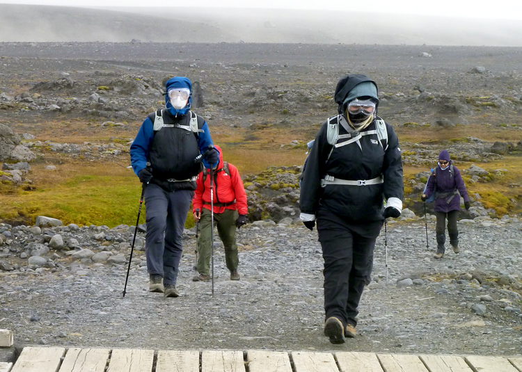
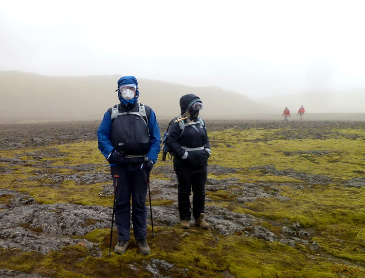
Luckily we were well equipped! Face masks and goggles from a local
DIY shop in Reykjavik was as high tech as it got – but it did the
job.
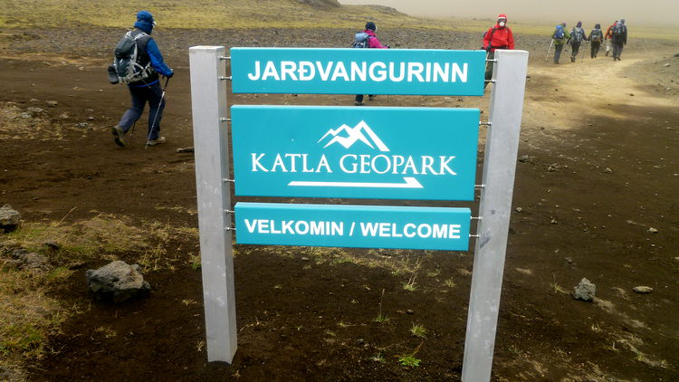
The walk through the Katla Geopark was exhilarating but sadly we did
not see very much as the ash was blowing around a lot making it hard to
see or even keep your eyes open for very long!
On arrival at the camp for the night fit for an episode of Dr Who and
a very blustery and ash blasted night in the tent to follow.
Þórsmörk.
The next day is the last one on the Laugavegur trail taking the route
to the Volcano Huts in Þórsmörk. We had decided that having camped this
far along the route we would, space permitting, treat ourselves to a bed
in a hut at the end of the day. So 17km to conquer before a real bed for
the night we set off.
The weather had calmed down and the dust masks and goggles could be
left behind. This section of the route is far greener and more vegetated
that the relatively barren landscapes that we had passed in the last few
days. We walked on through a wooded area, Thorsmork which means Thor’s
forest and for the first time on the walk we were passing through trees.
This was probably the quietest day of the walk but it seemed very long
and we were glad to arrive at the hut for the night. Never having stayed
in a hiking hut before, this was a first for me. We were lucky the hut
was quiet, otherwise, it could feel very cosy as you would sleep in
close proximity to your fellow walkers. This time of year in Iceland is
the very end of the walking season and pretty much as we moved on huts
were closing up for the winter.
Fimmvörðuháls and Eyjafjallajökull Trail
The last day of the trek and we had left the Laugavegur trail behind
to walk the last 28km on the Fimmvörðuháls and Eyjafjallajökull trail
which would lead us to the end of the walk at the Skogarfoss Waterfall
on the southern coast of Iceland.
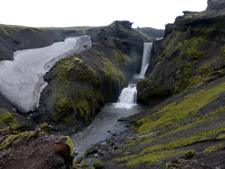
This day takes us past an apparently uncountable amount of
waterfalls. It is a fairly flat, but long walk always heading south. We
start off up the Fimmvorduhals Pass, past Falcon Cliff into a narrow
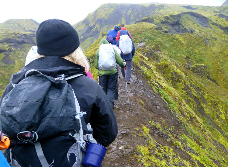
canyon. We walked on onto the Kattahryggur ridge, which we had been led
to believe was very narrow but actually proved to be very easily
crossable and certainly nothing scarier than you would encounter in the
Lakes or Snowdonia.
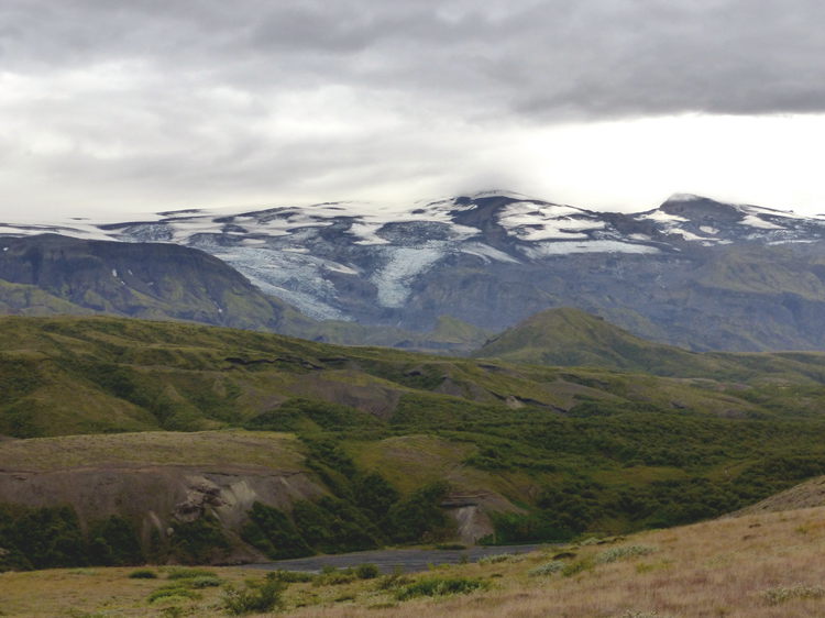
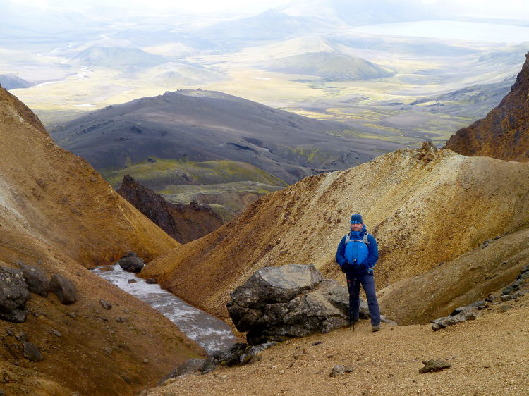
We walked on to the Fimmvorduhals Pass which is directly between the
two glacier-covered volcanoes of Myrdalsjokull to the east and the
infamous Eyjafjallajokull (the one responsible for the dust cloud that
grounded all flights for so long) to the west. Lunch today was taken
sitting on warm ground heated by geothermal activity beneath.
This day’s walk was long. There were lots and lots of waterfall to
see along the way.
But, despite this being the end of the trek and the end of our time
in Iceland, no-one was sad to see the greatest waterfall of all the
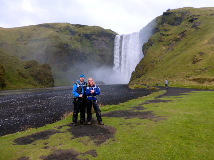
dozens and dozens we saw today. Skogarfoss Waterfall – amazing and
awe-inspiring but also the end of the route, time to head back to
Reykjavik and home!
Are you tired of being stuck in the office? Bored of being chained to a desk? Counting down the days until retirement?
Me too!!
CATEGORIES
FOLLOW US


RECENT POSTS
-
 Tuesday 01 February 2022
 -
 Monday 31 January 2022
 -
 Sunday 30 January 2022
 -
 Saturday 29 January 2022
 -
 Friday 28 January 2022
 -
 Thursday 27 January 2022
 -
 Wednesday 26 January 2022
 -
 Tuesday 25 January 2022
 -
 Monday 24 January 2022
 -
 Sunday 23 January 2022
 -
 Saturday 22 January 2022
 -
 Friday 21 January 2022
 -
 Thursday 20 January 2022
 -
 Sunday 02 January 2022
 -
 Saturday 01 January 2022
 -
 Wednesday 27 October 2021
 -
 Tuesday 26 October 2021
 -
 Sunday 02 May 2021
 -
 Sunday 04 October 2020
 -
 Saturday 03 October 2020